Construction & Commercial
Real Estate
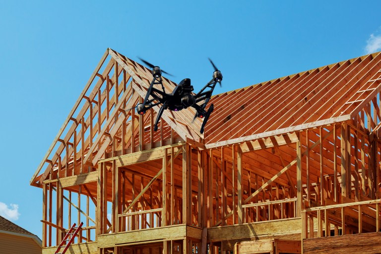
Industries and Operations
That Benefit From Drone Technology
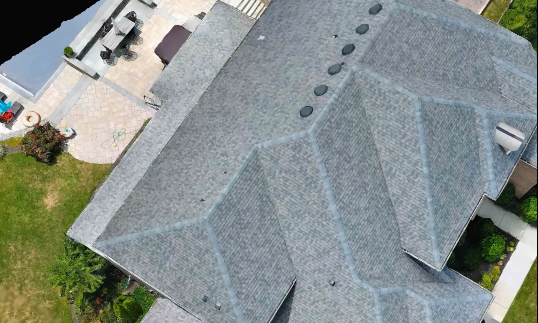
Roofing Companies
Energy & Utilities Maintenance
Real Estate
Construction Architecture and Engineering
Construction Project Management
Solar Panel Maintenance and Construction
Key Applications of Drones in Traditional Architecture and Engineering Include:
- Preliminary Construction Documentation
- Initial and Final Construction Planning
- Pre-Construction Site Work
- Site Monitoring
- Thermal Imagining
- Interior and Exterior Inspections
- 3D Modeling
- Marketing Your Property
Drone Utilization:
Lowers Costs
Reduce Downtimes
Increases Safety
In the fields of land development, property condition assessment, and architectural engineering, advanced drone technology is transforming operations. Drones dramatically reduce project downtimes, lower costs, and increase safety, while providing precise, detailed survey-grade results that surpass traditional methods.
Regular drone mapping updates ensure projects remain on schedule and facilitate seamless collaboration among stakeholders within a dynamic 3D environment at every stage of development.
In land development, drones offer comprehensive site analysis, optimizing land use planning and facilitating faster decision-making- transforming pre-acquisition and leasing due diligence. For property condition assessment, drones deliver high-resolution imagery and data, allowing for thorough and timely evaluations. Elevated viewpoint reduces the time required to find anomalies often missed during ground-level inspections. Inspectors and project managers can easily access and assess areas that are otherwise difficult to reach. In architectural engineering, drones are employed for accurate measurements and 3D modeling, enhancing design precision and collaborative efforts.
Whether surveying a small commercial lot or a vast 100-acre retail development, drones offer aerial perspectives that provide a comprehensive view not possible from the ground. Drones enhance the safety, efficiency, and cost-effectiveness. Lastly, when your project is complete, drone imagery can provide high-value real estate marketing solutions; setting you apart from your competition while impressing your target customer.
Transform Your Construction Workflow with Drone Solutions

- Pre-Construction Surveys
- Site Preparation Tasks
- Ongoing Site Monitoring
- Pre & Post Build Planning


Enhancing Real Estate Project Management
Pre-Construction Documentation:
- Comprehensive Site Documentation: We provide detailed photographic and video documentation of the project site prior to construction, ensuring a clear record of preexisting conditions. This includes capturing key vantage points, surrounding properties, and existing site features to mitigate future disputes and streamline project planning.
- Terrestrial Topology: Our drones capture high-resolution images and detailed maps, providing an accurate representation of the land. This data allows for precise planning and helps in identifying potential challenges early on.
- Vegetation Survey: Our drones conduct comprehensive vegetation surveys, enabling you to make informed decisions about land use, environmental impact, and necessary clearances.
- Contours and Terrain: Our drones generate accurate contour maps and 3D terrain models, offering a clear understanding of the landscape. This information is invaluable for site design, grading, and drainage planning.
Site Preparation:
- Earthwork: Our drones provide precise measurements and volumetric calculations, ensuring accurate earthwork planning and execution. This leads to optimized resource allocation and cost savings.
- Takeoff: Our drone technology delivers precise takeoff data, allowing for more reliable project estimations and better budget management.
- As-Built:Comprehensive as-built documentation is provided, capturing the exact state of the site at various construction stages. This ensures adherence to design specifications and facilitates any necessary real-time adjustments.
- Utilities: Our drones provide detailed utility mapping, helping you identify existing utilities and plan new installations with precision.
- Elevation: Drones deliver detailed elevation maps, ensuring that your project meets design specifications and regulatory requirements.
- 3D MODELING: Comparing as-built against design build
Comprehensive Site Monitoring:
- Stockpile Volume Estimations: Geotagged drone maps enable instant area measurements and stockpile volume estimates for real-time decision-making on the spot.
- Weekly Geo-referenced Map Updates: Monitor project progress with our weekly geo-referenced maps. High-resolution drone images provide detailed, up-to-date site views for informed decision-making.
- Safety Audits: Ensure safety with regular drone inspections, identifying hazards and ensuring compliance to minimize risks and maintain a secure site.
- Real-Time Site Plans: Manage projects efficiently with real-time site plans. Live drone updates enable quick adjustments to keep your project on track.
Pre & Post-Construction Planning
- Slab Pour Areas: Ensure precise slab pour planning with detailed drone measurements, minimizing errors and ensuring a smooth construction process.
- ROW (Right of Way): Manage right-of-way areas efficiently with comprehensive drone surveys, avoiding conflicts and ensuring regulatory compliance.
- Laydown Tracking: Monitor laydown areas accurately with drones, optimizing material storage, logistics, and site utilization.
- Crane Pick Plan: Enhance crane operations with detailed drone data, ensuring safe and efficient crane movements and lifts.
- Marketing Your Property: Showcase your property with stunning aerial photography and videography. Our drones capture breathtaking views that highlight your property’s best features, attracting potential buyers, lessees, and or investors.
UAVs For Construction and Real Estate Project Management


The Benefits Of Drones
One of the main advantages our clients find with drone maps is the ability to easily, quickly, and efficiently share and collaborate on data without needing to be onsite
Drones enable efficient construction site monitoring through “construction aerial progress monitoring.” Regular drone flights collect project data, documenting progress and changes to ensure compliance with agreements. Construction managers are adopting weekly drone mapping to track progress, inspect safety, and gather real-time data. Geotagged maps allow for basic measurements and stockpile estimates, seamlessly integrating with industry software for advanced planning.
Drone technology revolutionizes construction site inspections by allowing remote calculations of stockpile volumes, material cost estimations, and other essential data collection. Orthomosaics facilitate aerial inspections, securing equipment and materials, and inspecting rooftops, solar installations, and deteriorating buildings. Additionally, they provide accurate imagery for legal proceedings, making them valuable in court cases.
Drone maps help engineering and survey teams quickly achieve accurate topographic data by locating existing site grading, drainage spots, vegetation, and waterways. This data can then be used to measure accurate distances from the planning and pre-construction stages to the final inspection. Consequently, drone mapping can streamline every stage of a construction project. By integrating drone data into the BIM process, CAD designs can be overlaid with real-world 3D models, ensuring accurate construction by comparing the plans (“design-build”) with the actual completed structure (“as-built”).
Experience the ultimate marketing solution with our drone videos, providing breathtaking aerial views that grab attention. Paired with our high-quality ground videography and professional graphic design, we create exceptional content that shines on every platform, from your website to social media. This seamless integration of aerial and ground footage ensures your message is delivered with maximum impact and efficiency.

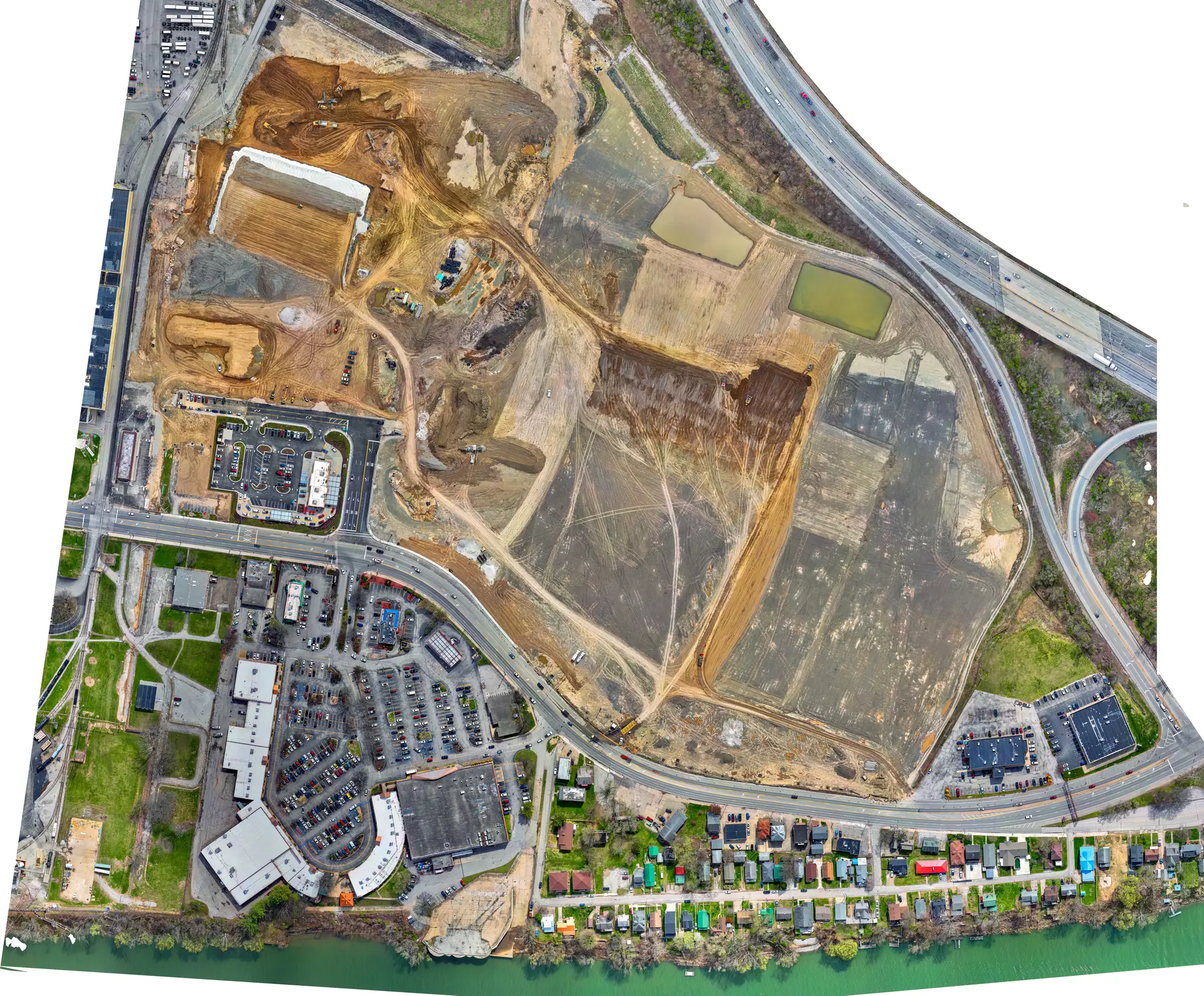
Orthomosaic Maps and Photogrammetry Mapping:
Essential Tools for Accurate Construction Data
Unforgettable Memories with DEXFLY

Orthomosaic Maps are high-resolution, detailed composite images created by stitching together hundreds or thousands of drone-generated photos. This process, known as photogrammetry, involves using powerful software to correct lens distortion, camera tilt, and topographic relief. Unlike standard aerial photos, orthomosaic maps have a uniform scale and embedded metadata for geo-location, date, altitude, and camera details, making them ideal for precise measurements.
Photogrammetry itself uses advanced processing software to remove distortion and stitch individual images into georeferenced mosaics. Once completed, these maps allow you to view different layers, such as the orthomosaic, elevation, surface, and terrain layers. This data is crucial for accurately locating existing site grading, drainage spots, vegetation, and waterways.


Contact Us